 | Kilimanjaro
Eighteen years of climate & glacier research
|

Overview below; please go
here for news & updates!
Check last month's weather at the summit and August 2016 images
Between 1912 and 1989, the extent of ice cover on the highest massif in Africa decreased by 75% (Hastenrath and Greischar, 1997: J. Glaciology, v. 43, p. 455-459). Over the next 11 years (1989-2000) nearly one quarter of the remaining ice area was lost [map]. Given the current rate of disintegration, the glaciers on Kilimanjaro may completely disappear within a few decades. To place the 20th century climatic and environmental changes in East Africa within a longer-term perspective, Prof. Lonnie Thompson and his team from Ohio State University drilled 6 ice cores through 3 different glaciers on the mountain during January and February, 2000. A paper detailing the Holocene environmental history recorded in these cores was published in Science, October 2002; included in this paper are our initial meteorological findings and glacier measurements. Click here for a list of our other Kilimanjaro publications, here for the most-recent updates on the project (and here to contact us).
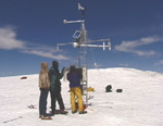
In conjunction with the ice core drilling effort, and modeling we are doing, our group from the University of Massachusetts installed an automated weather station (AWS) on Kilimanjaro's Northern Icefield. Since February of 2000, we have been maintaining this station and monitoring the mass balance of summit glaciers, which continue to retreat! Overall, this project has several objectives:
- to characterize the current climate at the summit of Kilimanjaro, and thus help develop a more comprehensive view of climatic conditions at high altitudes in this part of the Tropics,
- to help understand the causal mechanisms driving the environmental changes underway,
- to link the mountain climate to longer-term records at lower elevations, and
- to aid in the interpretation of the ice core record.
The Kilimanjaro weather station operates autonomously using solar power (25 watts), under control by a datalogger. Measurements made during the first two years include air temperature (aspirated to avoid sensor heating), humidity, incoming solar radiation, wind speed and direction, barometric pressure, and changes in the surface height of the ice cap (accumulation/ablation). These were very successful, and a brief synopsis of data from the initial years is available. Additional sensors were added in July 2002, and again in September 2004 when we also expanded our mass balance measurements. In February 2005 an automated camera ("cloudcam") was installed at the site to document diurnal weather patterns. A comprehensive analysis of the full meteorological record is underway!
Acknowledgments
We are extremely grateful for support and assistance to this project from:
- U.S. National Science Foundation, Paleoclimate & Earth System History Programs
- NOAA Office of Global Programs, Climate Change Data and Detection Program
- Tanzania Commission for Science and Technology, Dar es Salaam
- Our Tanzania Meteorological Agency colleagues Tharsis Hyera, Dr. Emmanuel Mpeta, and Ms. Juliana Adosi
- Georg Kaser, University of Innsbruck Geography Institute (image!)
- Kilimanjaro National Park, Arusha
- Tanzania National Parks, Marangu
- Ministry of Natural Resources, United Republic of Tanzania, Dar es Salaam
- Immigration Services, United Republic of Tanzania, Dar es Salaam
- Tanzania Revenue Authority, Dar es Salaam
- Simon Mtuy, guides Emmanual and Ferdinand, and everyone at Summit Expeditions
- Desmond, Seamus, Finnualla, and the Marangu Hotel staff
- Keys Hotels Limited in Moshi, and our great guide Eric
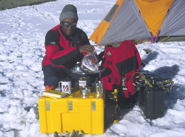
- Hardigg Cases, South Deerfield, Massachusetts (Click to see their cases in action: A B C )
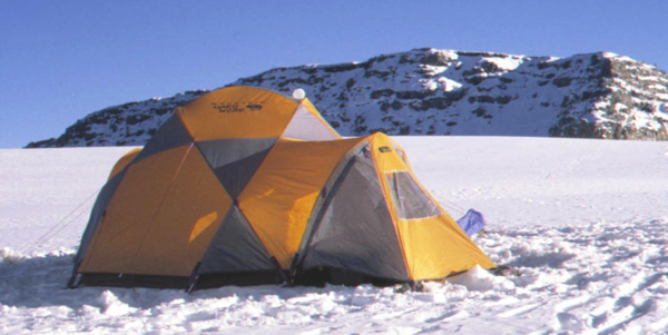
Our tent? A "Weather Station" from Mountain Hardware!

Climate System Research Center | Department of Geosciences | University of Massachusetts
Document maintained by Doug Hardy (dhardy@geo.umass.edu)
Last updated: 28 June 2018
http://www.geo.umass.edu/climate/kibo.html
Any opinions, findings, and conclusions or recommendations expressed in this material are those of the author and do not necessarily reflect the views of the National Science Foundation.
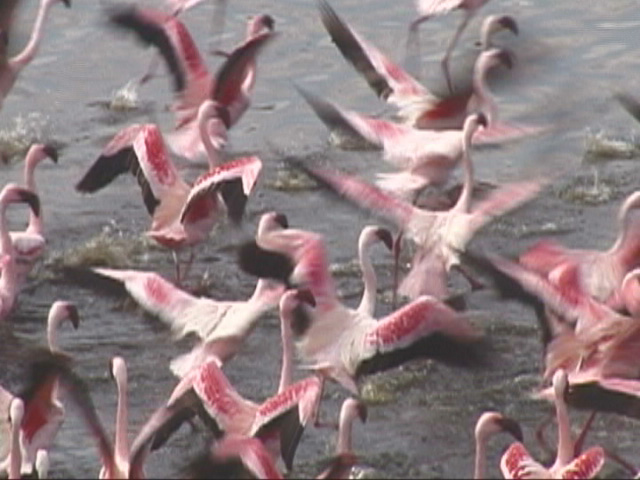
(Background: Lesser flamingos at Momela Lakes, Arusha National Park)