San Andreas Fault 2008
Expedition
to Southern California Area
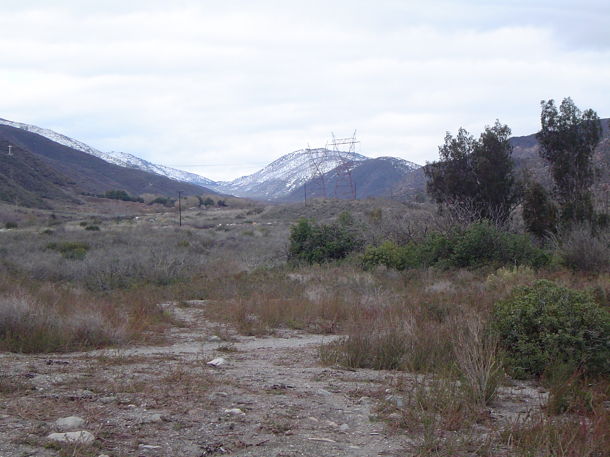
In the 'v' between the two mountains is where the San Andreas Fault is located. |
A
collaborative workshop and field trip of students and teachers of
SOAR-high and geologists at the University of Massachusetts, Amherst
researching Fault System Evolution
May
4 - May 10, 2008
updated: 05/2/08 |
Goals
of the trip:
The purpose of this trip is to help deaf students and teachers of the deaf to visualize the faulting system in 3-D of the San Andreas Fault System. The trip will allow the students to interact with their peers from different schools and learn more about geology of this area.
 |
 |
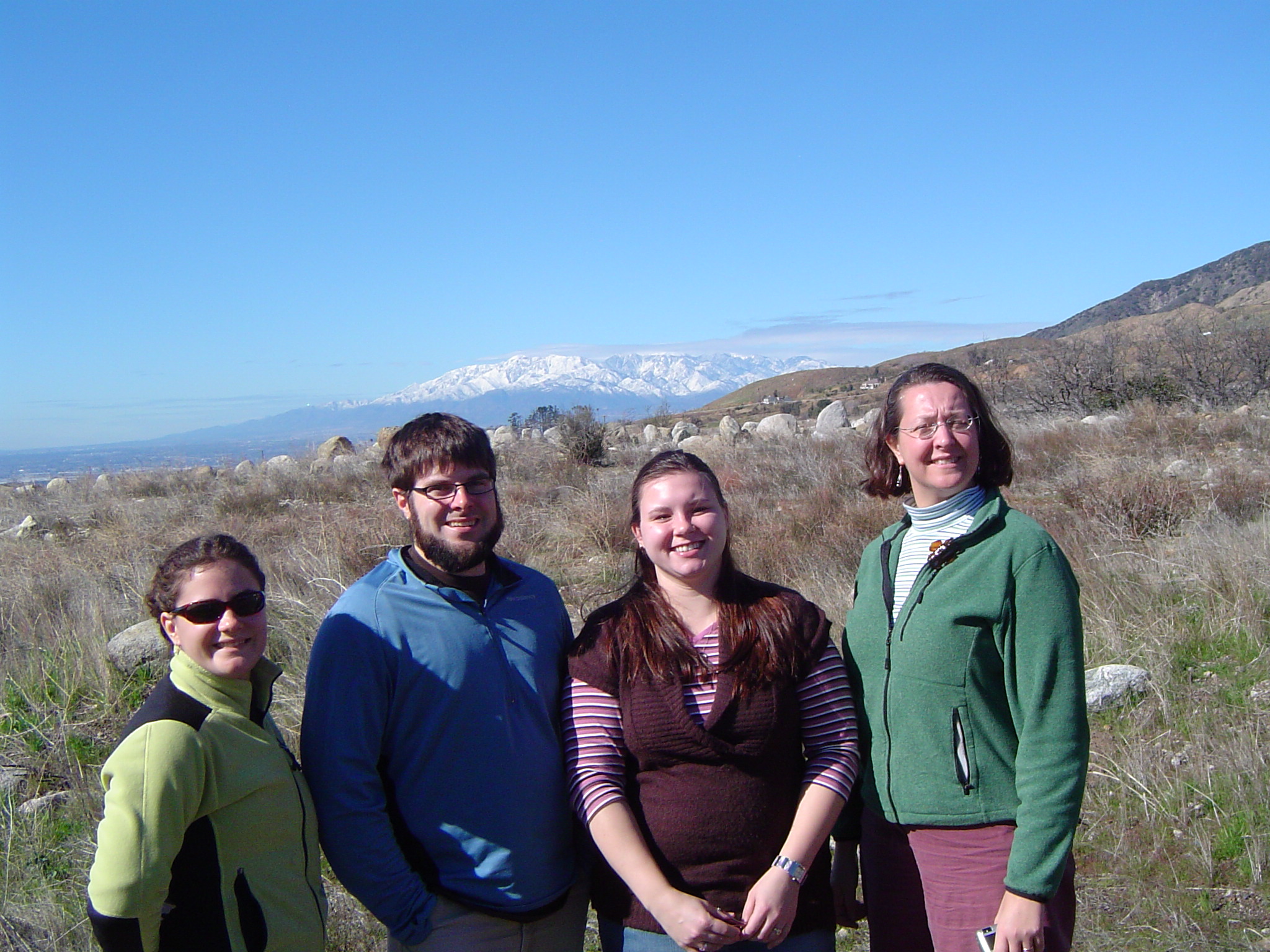
Laura, Scott, Erin & Michele standing in front of the San Bernardino Mountians |
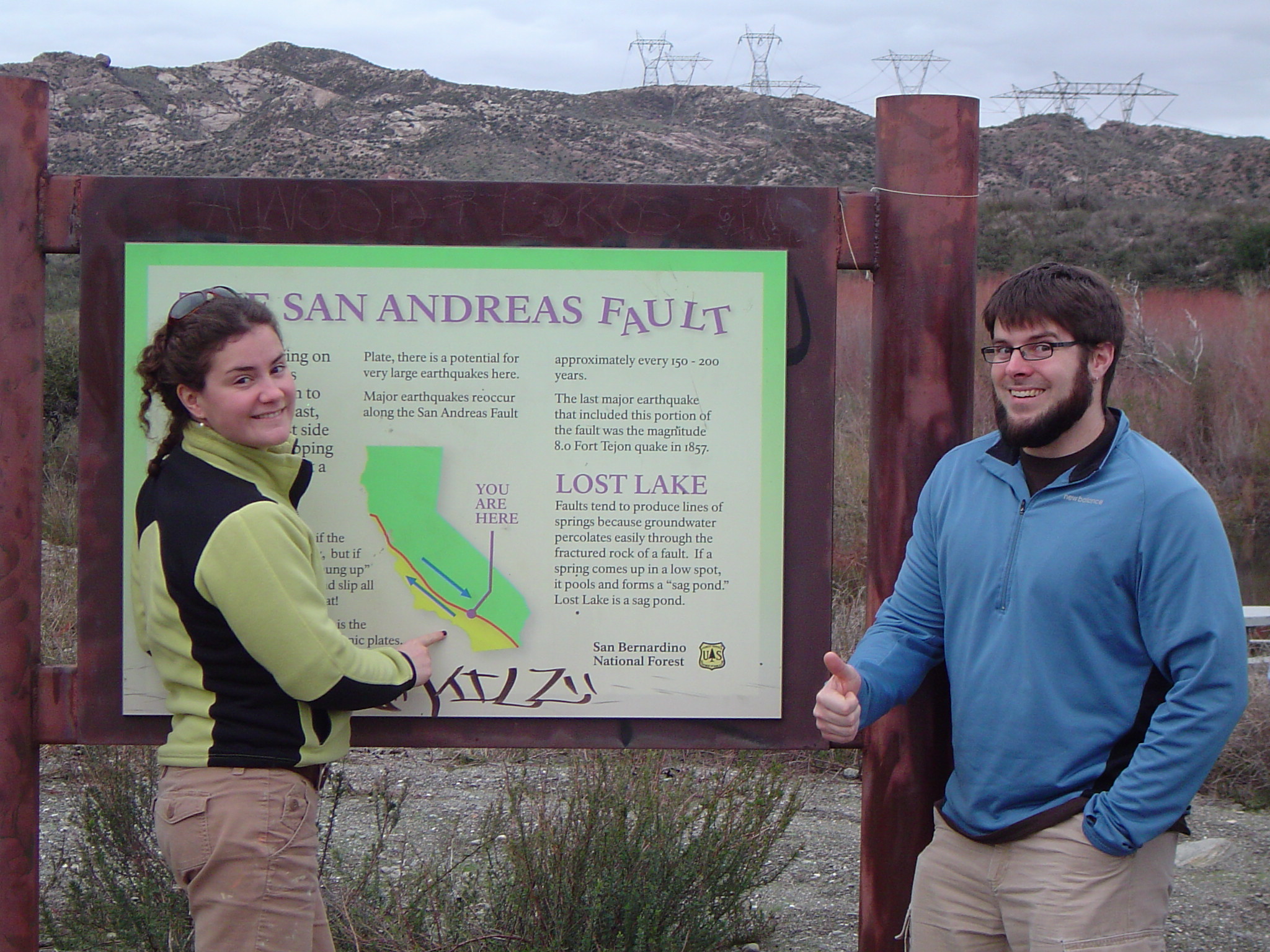
Laura and Scott standing next to the San Andreas Fault sign at the Lost Lake |
Come see who's involved in the FIF 2008 trip?!
SCHEDULE OF EVENTS
Day |
Events |
Locations |
Lodging |
Sunday, May 4 |
- Arrival Traveling Day
- settling in lodging arrangements
Everyone buys their own dinner |
|
Riverside
|
|
| Monday,
May 5 |
- San Bernardino Valley
- Forest Falls
- Devore
- Punchbowl Fault
- Lost Lake
Dinner at CSDR |
The house was built on top of a landslide. This was taken in the town of Devore, CA |
Riverside |
|
| Tuesday,
May 6 |
- San Jacinto Valley
- Hot Springs Fault
- 1000 Palms
- San Jacinto Tram
Dinner at the Tram (Ride N Dine) |
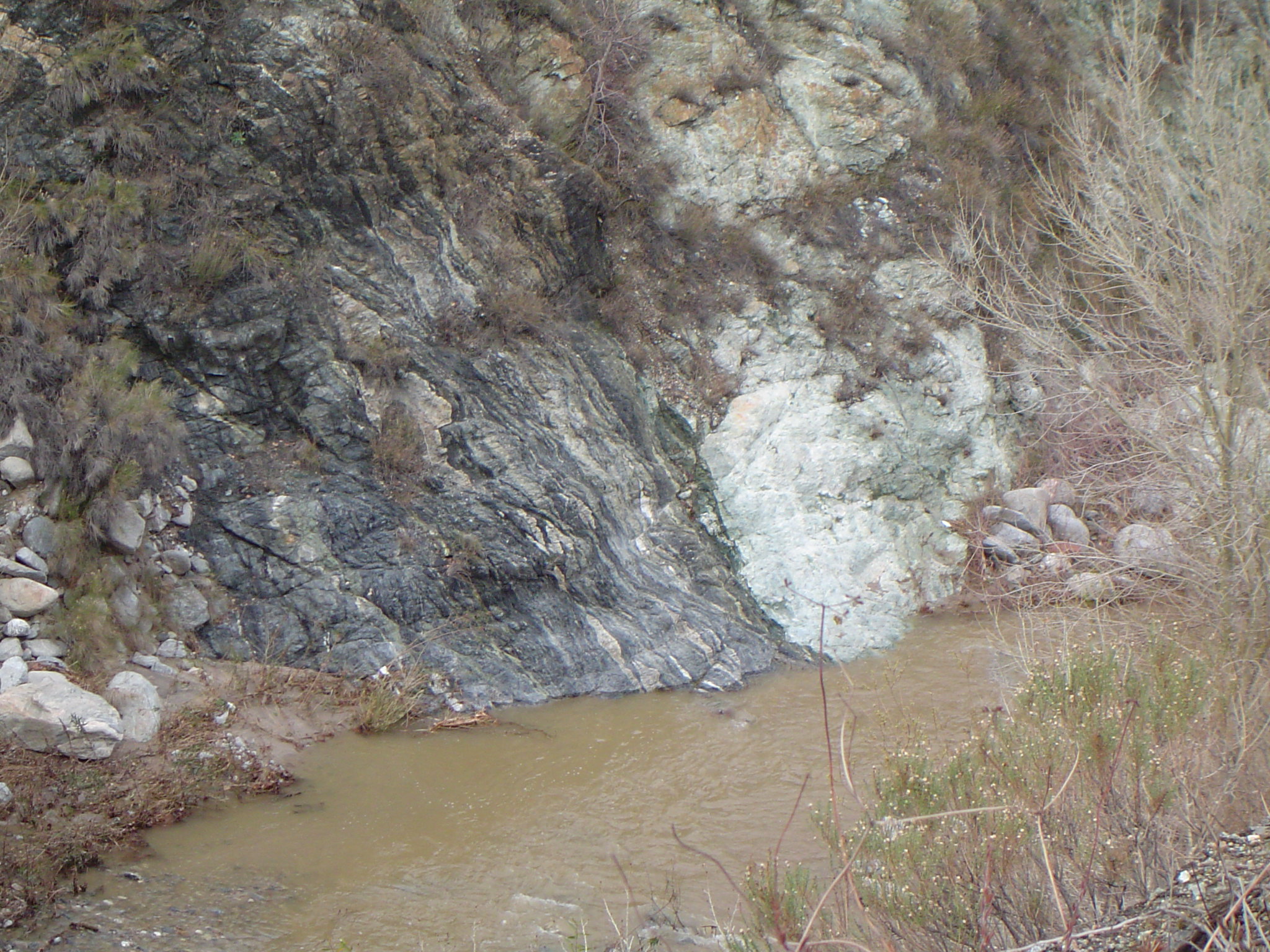
The fault is located between the grey rock on the left and the white rock on the right
|
Long Beach |
|
| Wednesday,
May 7 |
- Portuguese Bend Landslide
- La Brea Tar Pit
- Griffith Park
- Hollywood area
Pizza Dinner at Comfort Inn Suites |
La Brea Tar Pit
|
Long Beach |
|
| Thursday,
May 8 |
- San Onofre State Beach
- Tidepooling at Laguna Beach
- Aliso Creek Beach
Barbeque on Aliso Beach |
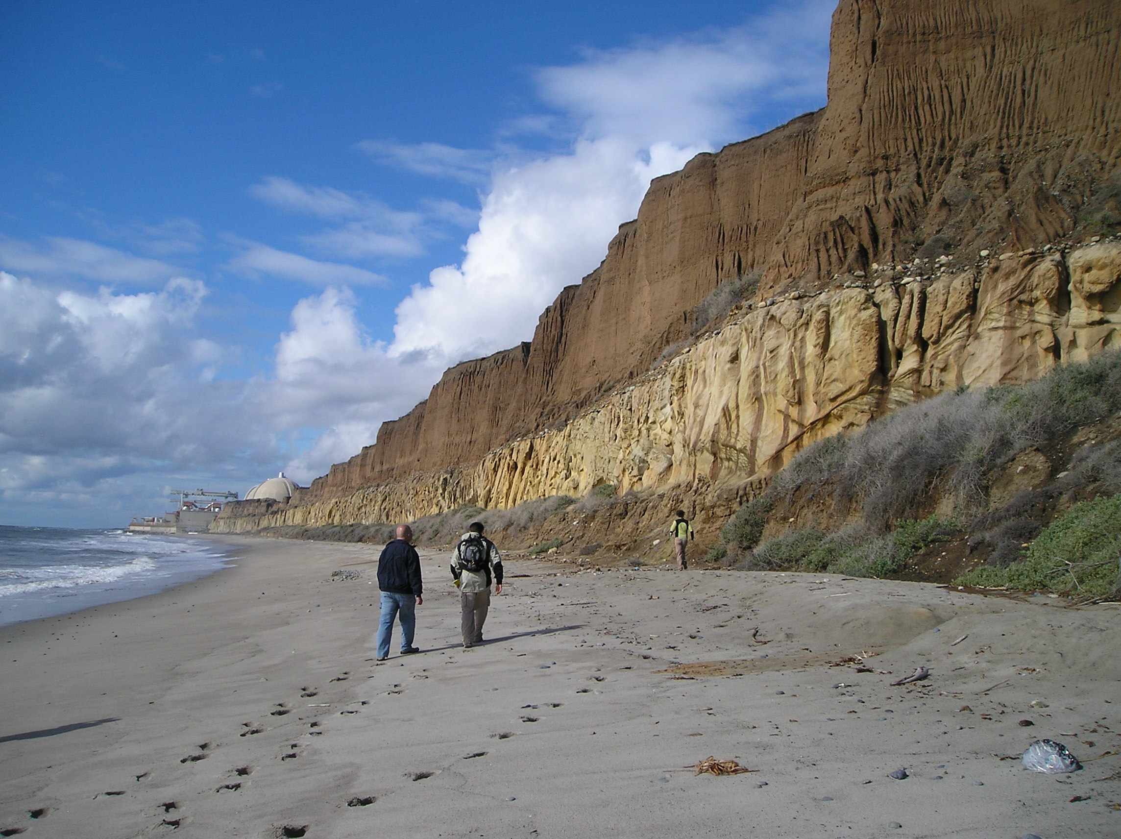
This was taken in San Onofre, if you look at the image closely, you can see a white dome. The white dome is the Nuclear Power Plant and it is situated near a fault
|
Long Beach |
|
| Friday, May 9 |
- Final presentation at University High School in Irvine, CA.
Dinner at Marriot Riverside |

University High School - Deaf & Hard of Hearing program
|
Riverside |
|
| Saturday, May 10 |
|
|
|
|
Virtual Reality Google Earth Field Trip: This program will allow you to view each location site that we will be visiting in Southern California. They are organized by day: Day 1, Day 2, etc. You can use this program to get an idea of where we will be going and the different activities that we will be doing.
INSTRUCTIONS: Before you can download the files, you need to download the program itself: Google Earth. The download button is located on the right - the green button that says "Download Google Earth (Free)". Click the "Agree and Download" button and then the program will be downloaded into your computer. Then you can return to this webpage and download the virtual reality field trip files. Click the link to download the Virtual Reality Field Trip file. The name of the file is CA_FIF2008_4.kmz. The colors on the PushPin markers are separated into days: Day 1: Purple, Day 2: Green, Day 3: Yellow, Day 4: Orange and Day 5: Blue. Enjoy!
Photos of the reconnaissance trip from January 23-27 are located in these links below
Day 1 - San Onofre/Laguna Beach
Day 2 - Griffith Observatory/Santa Monica/Downtown LA
Day 3 - San Gorgonio Mountains/Forest Falls/San Bernardino Mountains/Cajon Pass/San Andreas Fault