Historical Atlas of Massachusetts
Richard W. Wilkie and Jack Tager - Published in 1991
Selected Maps (Click on thumbnail to view full-size map):
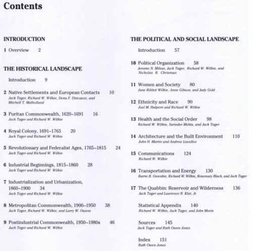
Overview Maps of Massachusetts
 |
 |
 |
|
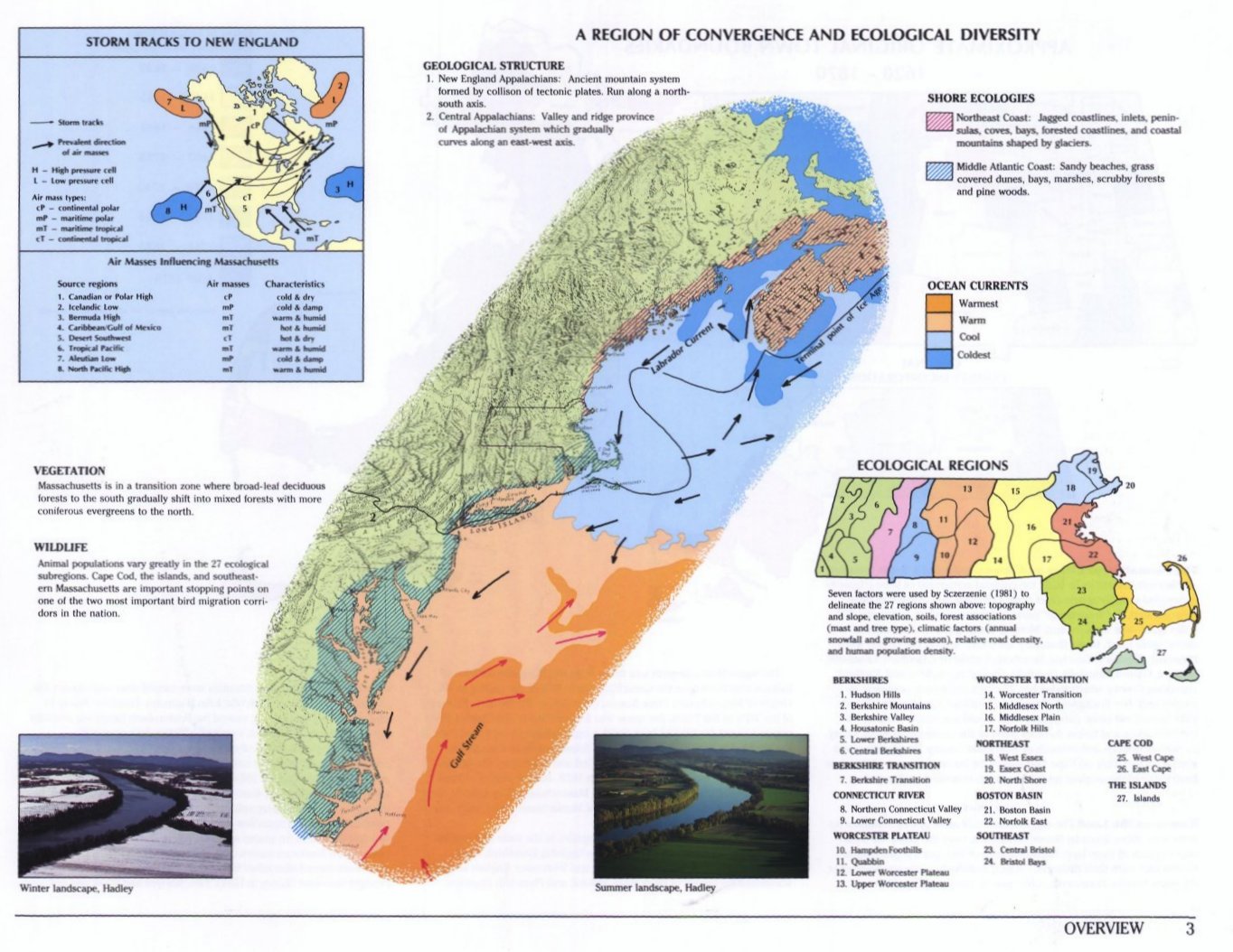
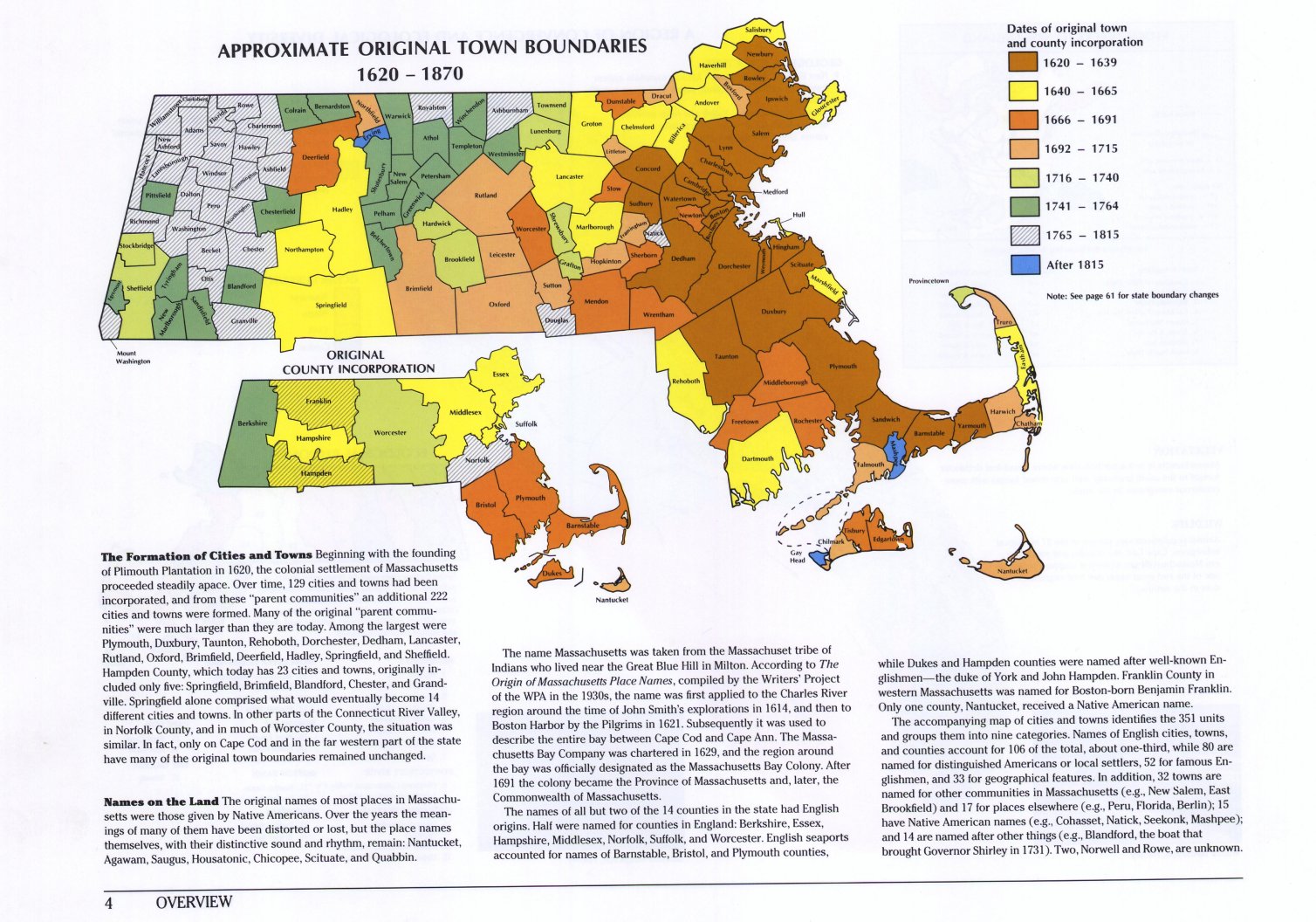
| Page 3: A region of convergence and ecological diversity. | Page 4: Approximate original town boundaries. | Page 5: Origin of city and town names and place names in 1980. | |
 |
 |
 |
|
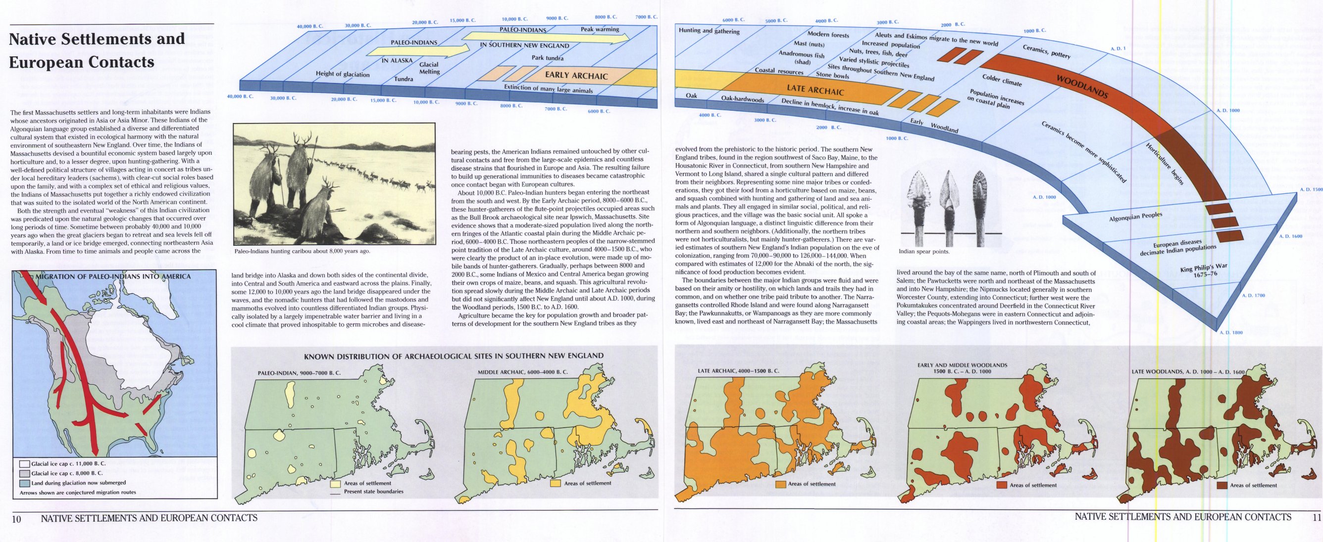
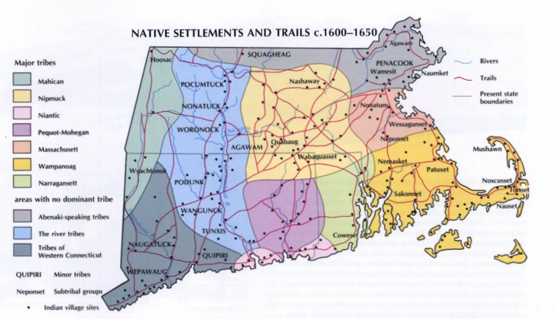
| Page 7: Spirit of place. | Pages 10 & 11: Native Settlements and European contacts. | Page 12: Native settlements and trails - 1600 to 1650. | |
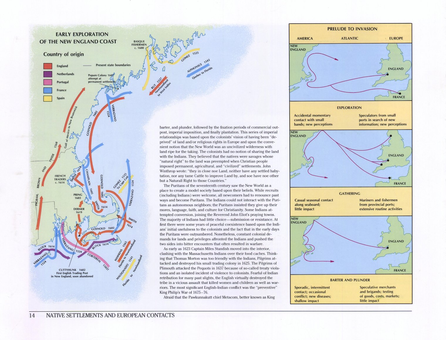 |
 |
 |
|
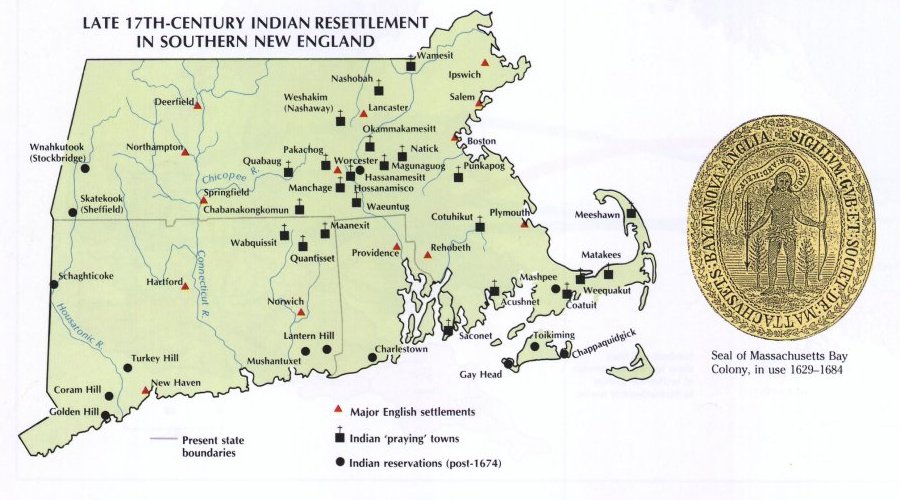
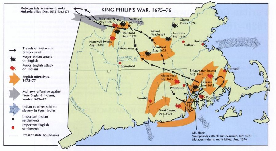
| Page 14: Early exploration of the New England Coast. | Page 15: Late 17th Century Native American resettlement. | Page 15: King Phillip's War: 1675 to 1676. |
Spread of European Settlement in Massachusetts
 |
 |
 |
 |
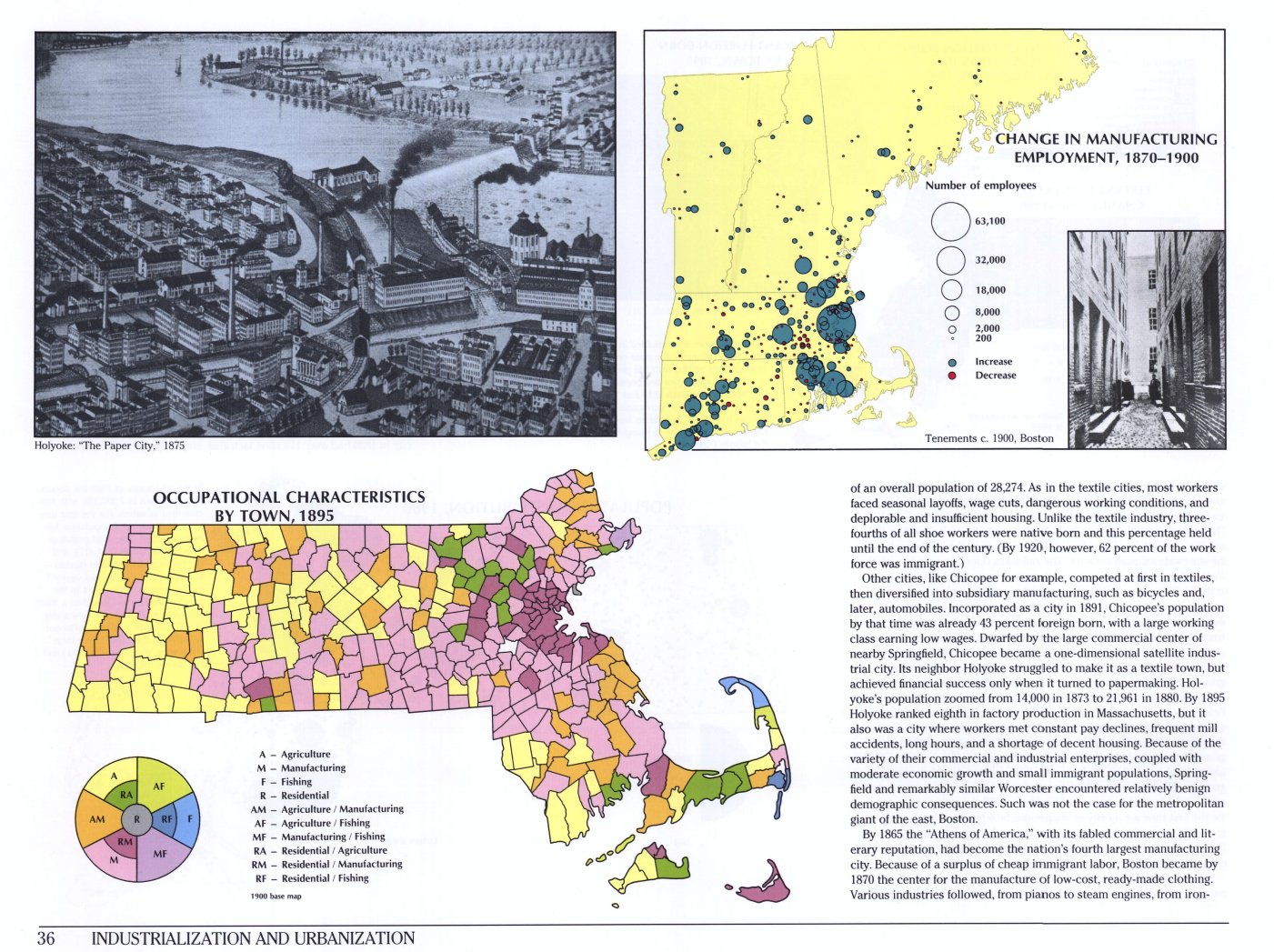 |
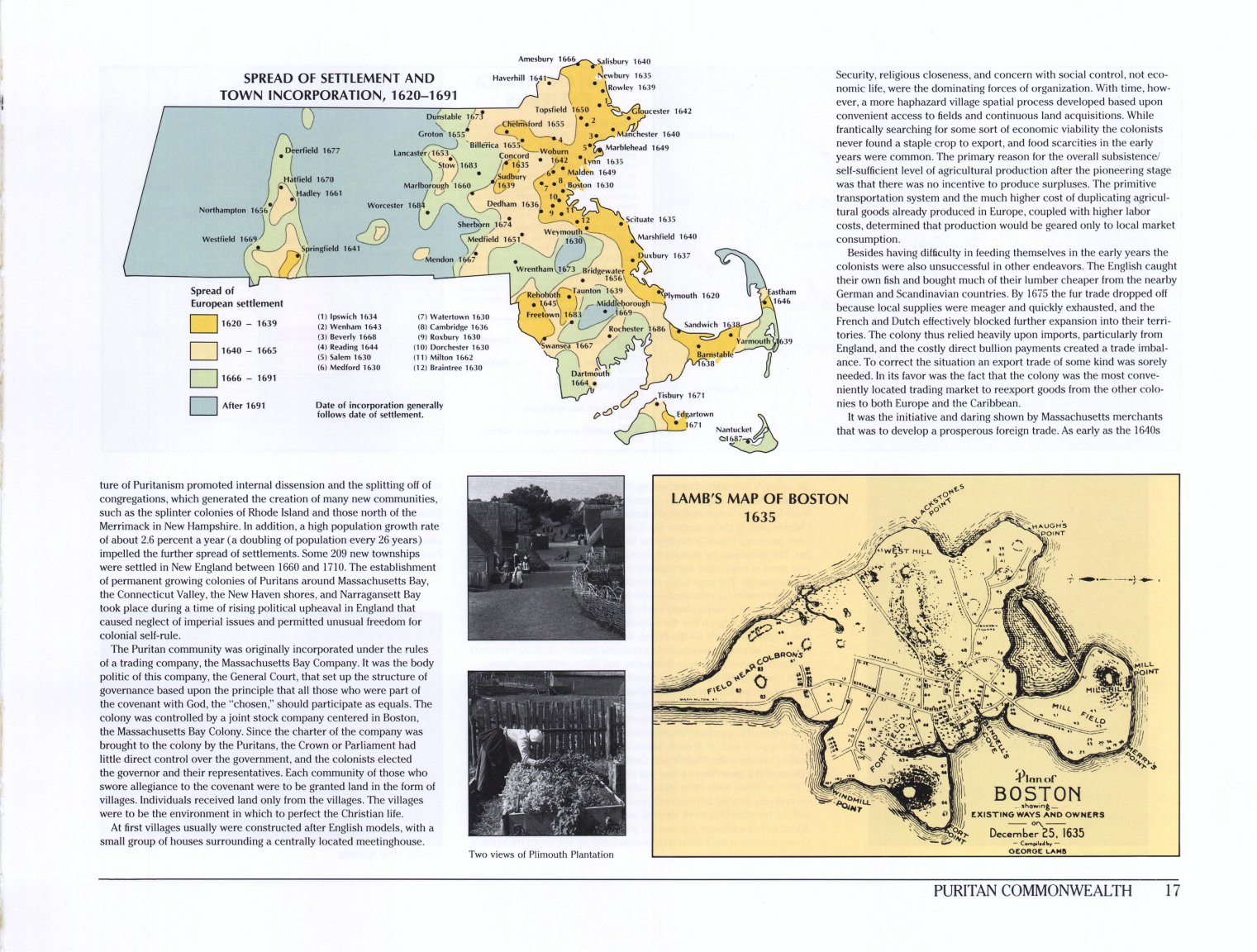
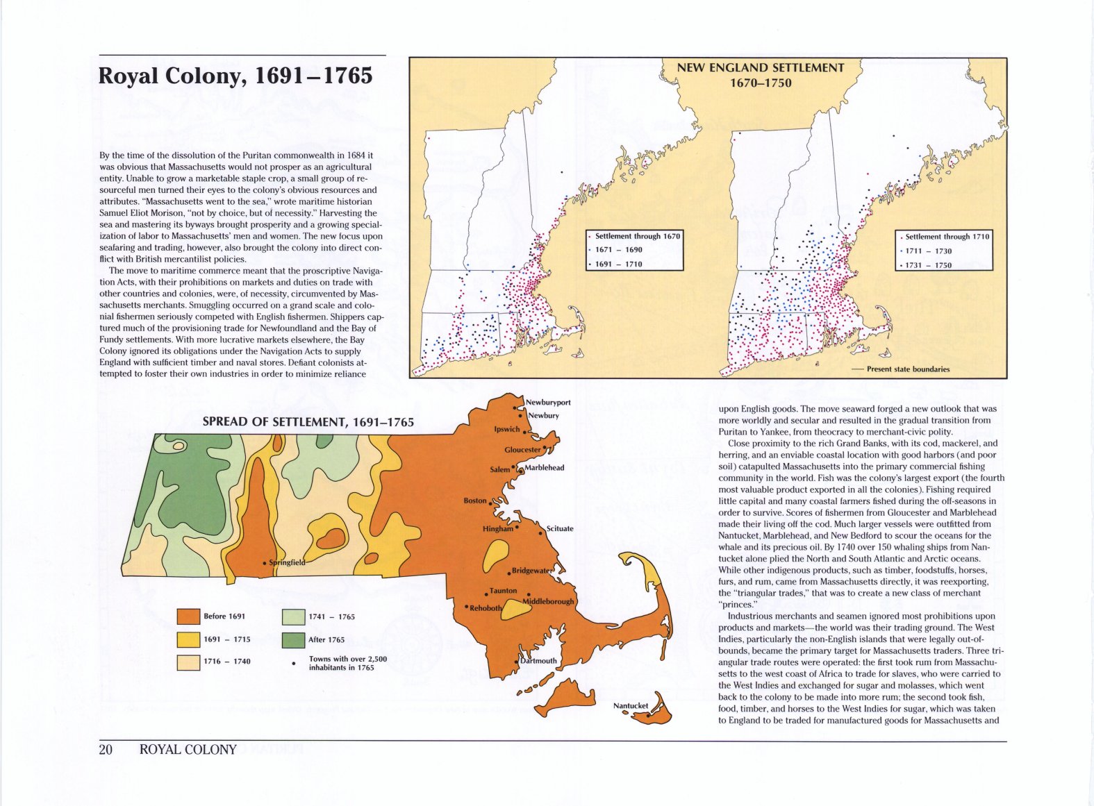
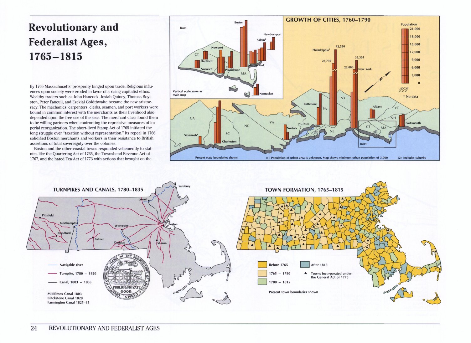
| Page 17: Spread of settlement and town incorporation, 1620 to 1691. | Page 20: Spread of settlement, 1691-1765. | Page 24: Town formation, 1765-1815. | Page 28: Town incorporations, 1815-1860. | Page 36: Occupational characteristics by town, 1895. |
Settlement Population Maps in New England
|
 |
|||
| Page 20: New England settlement, 1670 to 1760. | Page 27: New England settlement, 1750-1800. |
Population Distribution
.jpg) |
 |
.jpg) |
.jpg) |
.jpg) |
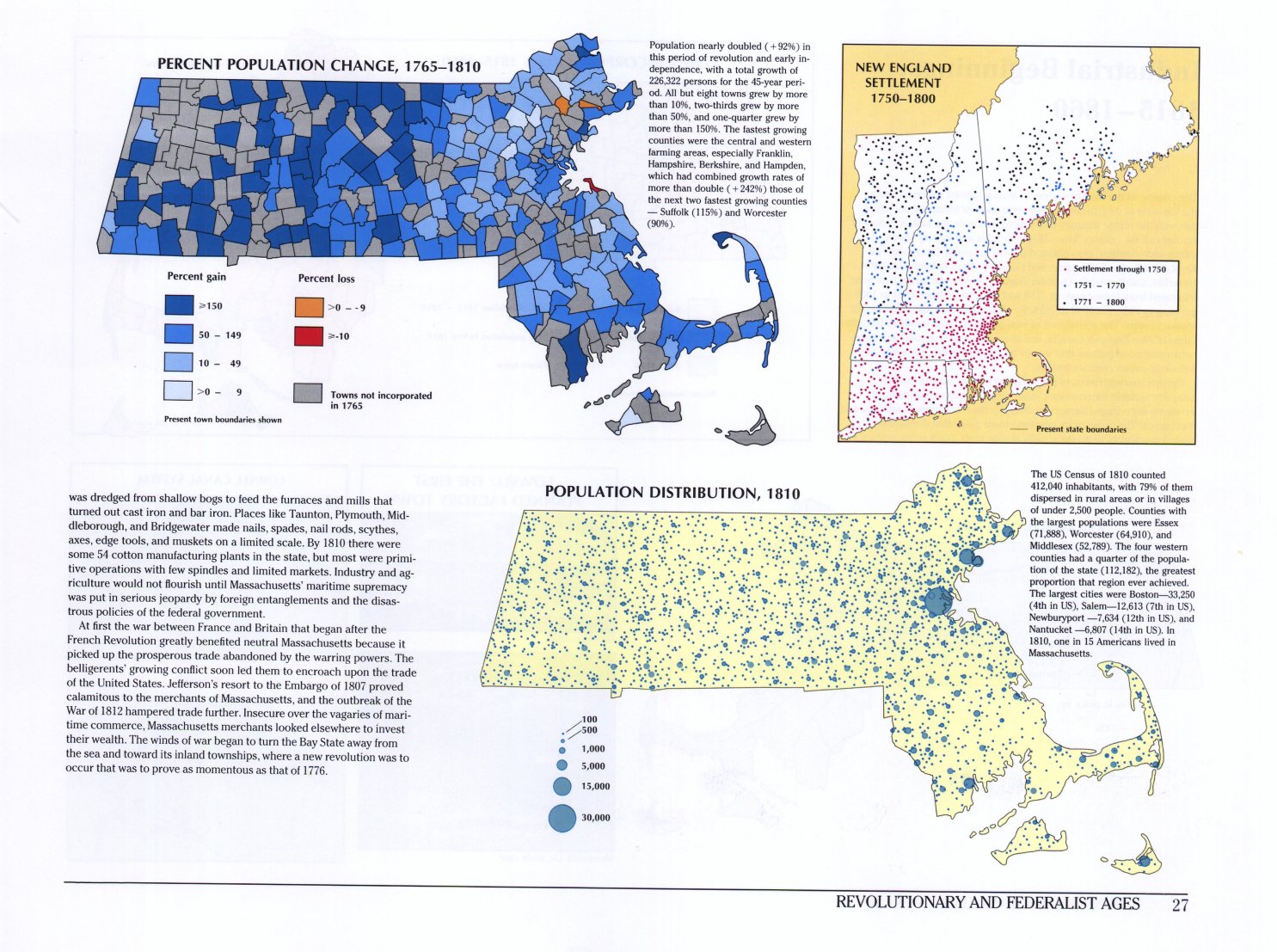
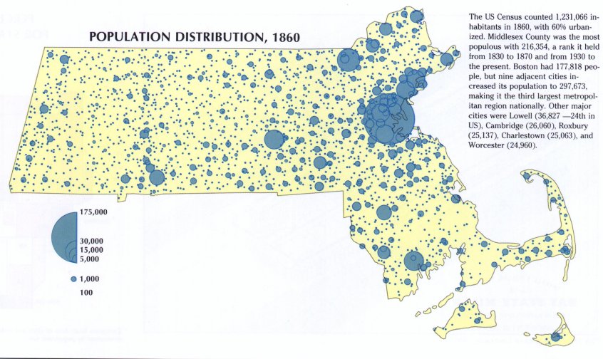
| Page 27: Population distribution, 1810. | Page 32: Population distribution, 1860. | Page 35: Population distribution, 1900. | Page 39: Population distribution, 1950. | Page 47: Population distribution, 1975. |
.jpg) |
||||
| Page 43: Population distribution, New England, 1930. |
Transportation and Communication
.jpg) |
.jpg) |
.jpg) |
 |
|
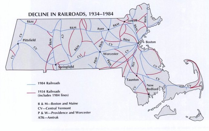
| Page 24: Turnpikes and railroads, 1780-1835. | Page 28: Railroads, 1835-1855. | Page 34: The railroad network in 1892. | Page 39: Street railroads and railways, 1905. | Page 46: Decline in railroads, 1934-1984. |
 |
.jpg) |
.jpg) |
.jpg) |
|
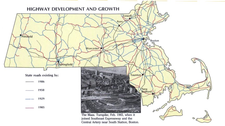
| Page 46: Highway development and growth, 1905-1986. | Page 131: Traffic volume, 1984. | Page 130: U.S. transportation firsts originating in Massachusetts. | Page 124: U.S. communication firsts originating in Massachusetts. |
Boston Specialty Maps
 |
 |
 |
 |
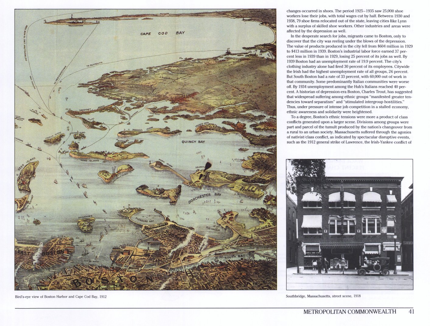 |
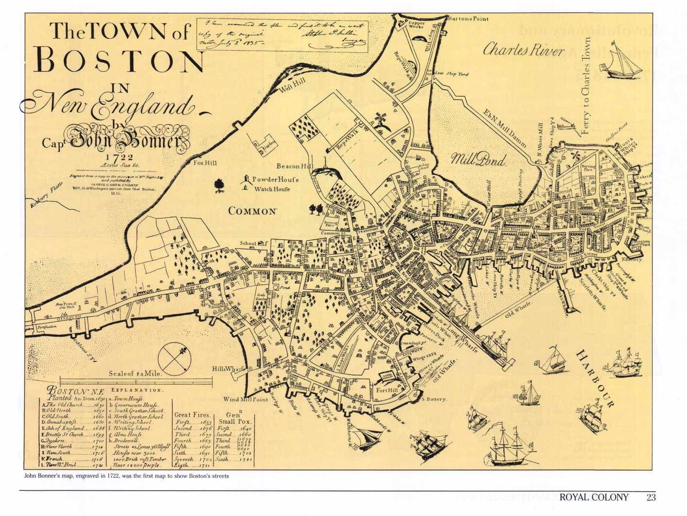
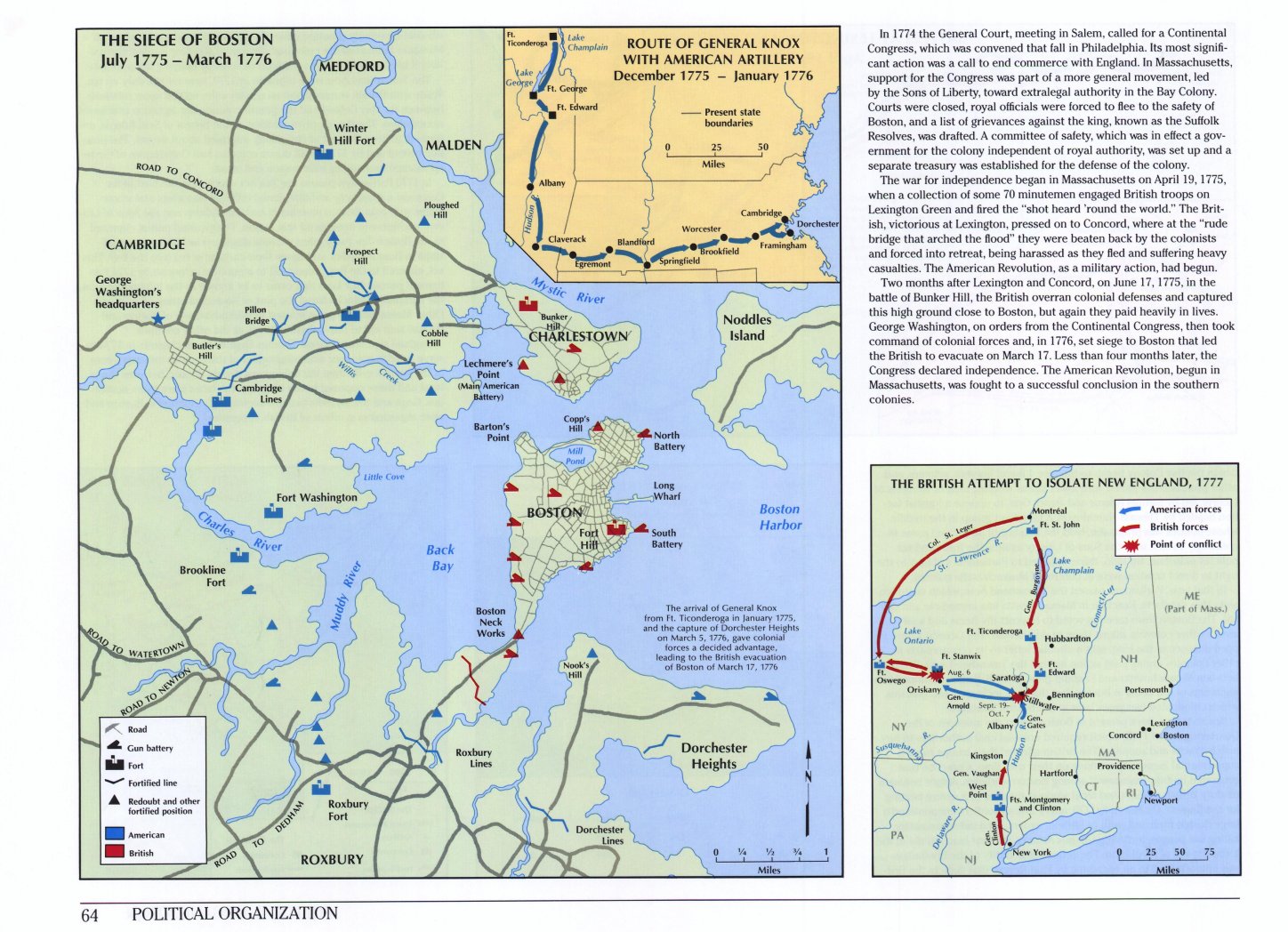
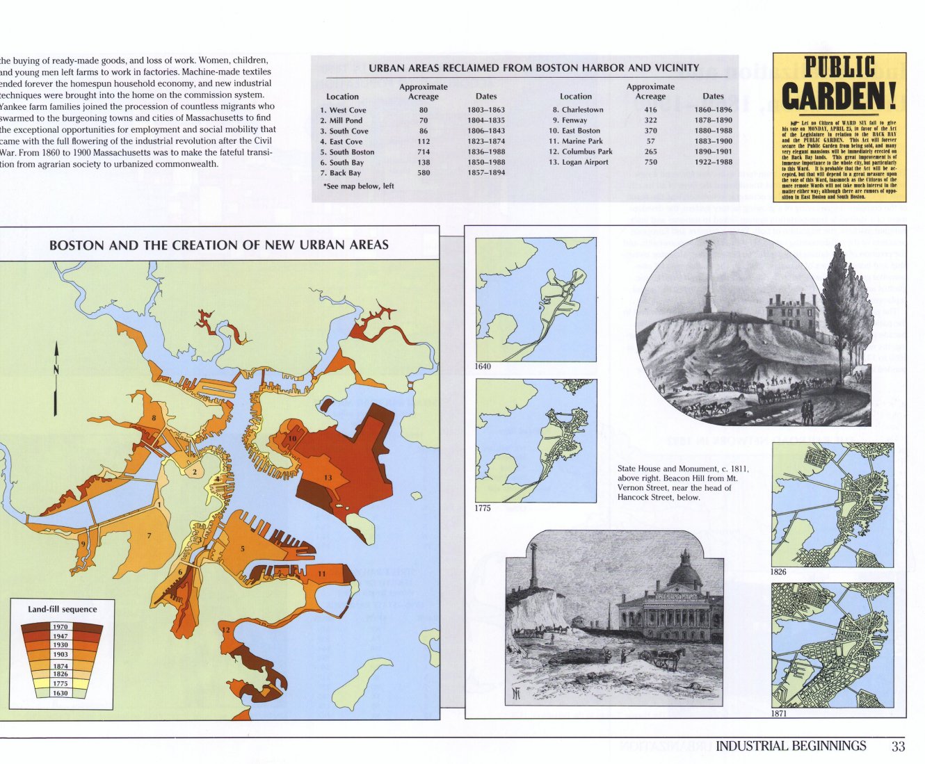
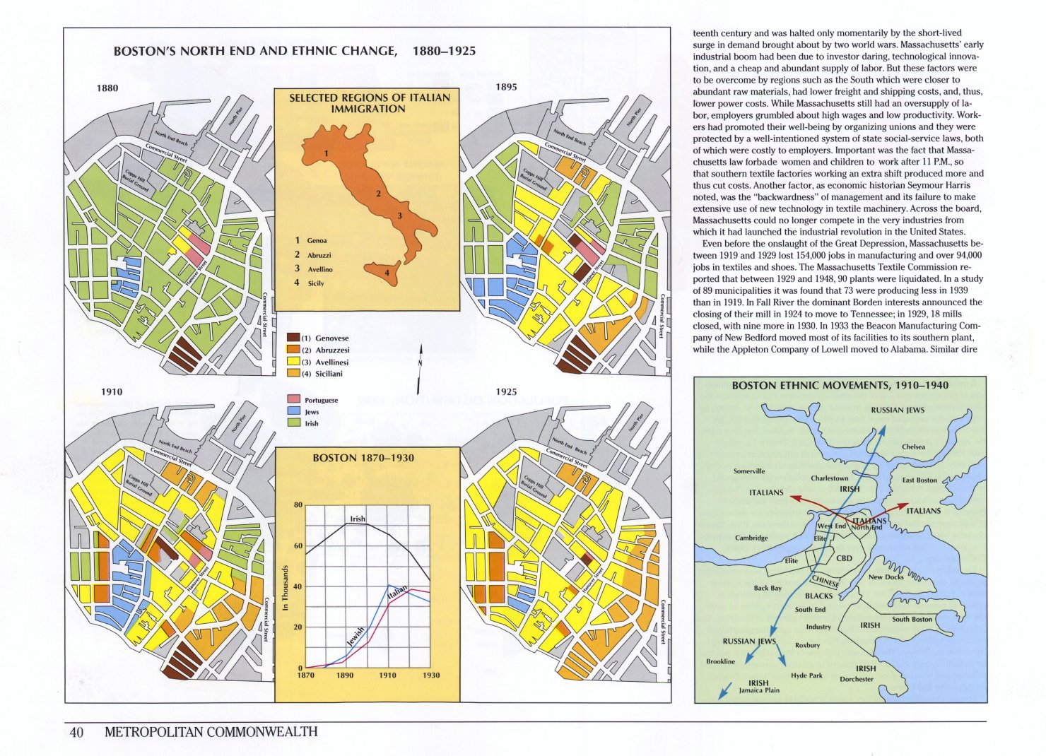
| Page 23: The town of Boston, 1722. | Page 64: The siege of Boston, July 1775 to March 1776. | Page 33: Boston and the creation of new urban areas. | Page 40:Boston's North End and ethnic change, 1880-1925. | Page 41: Bird's eye view of Boston Harbor and Cape Cod Bay, 1912. |
 |
||||
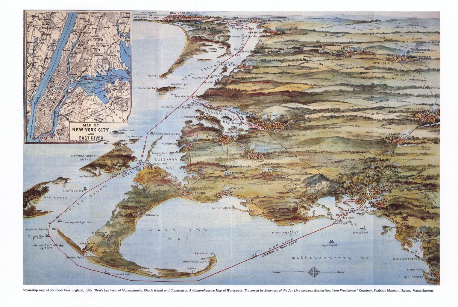
| Page 56: Bird's Eye map of Boston and Cape Cod, 1905. |
Cartogram Series
 |
 |
.jpg) |
 |
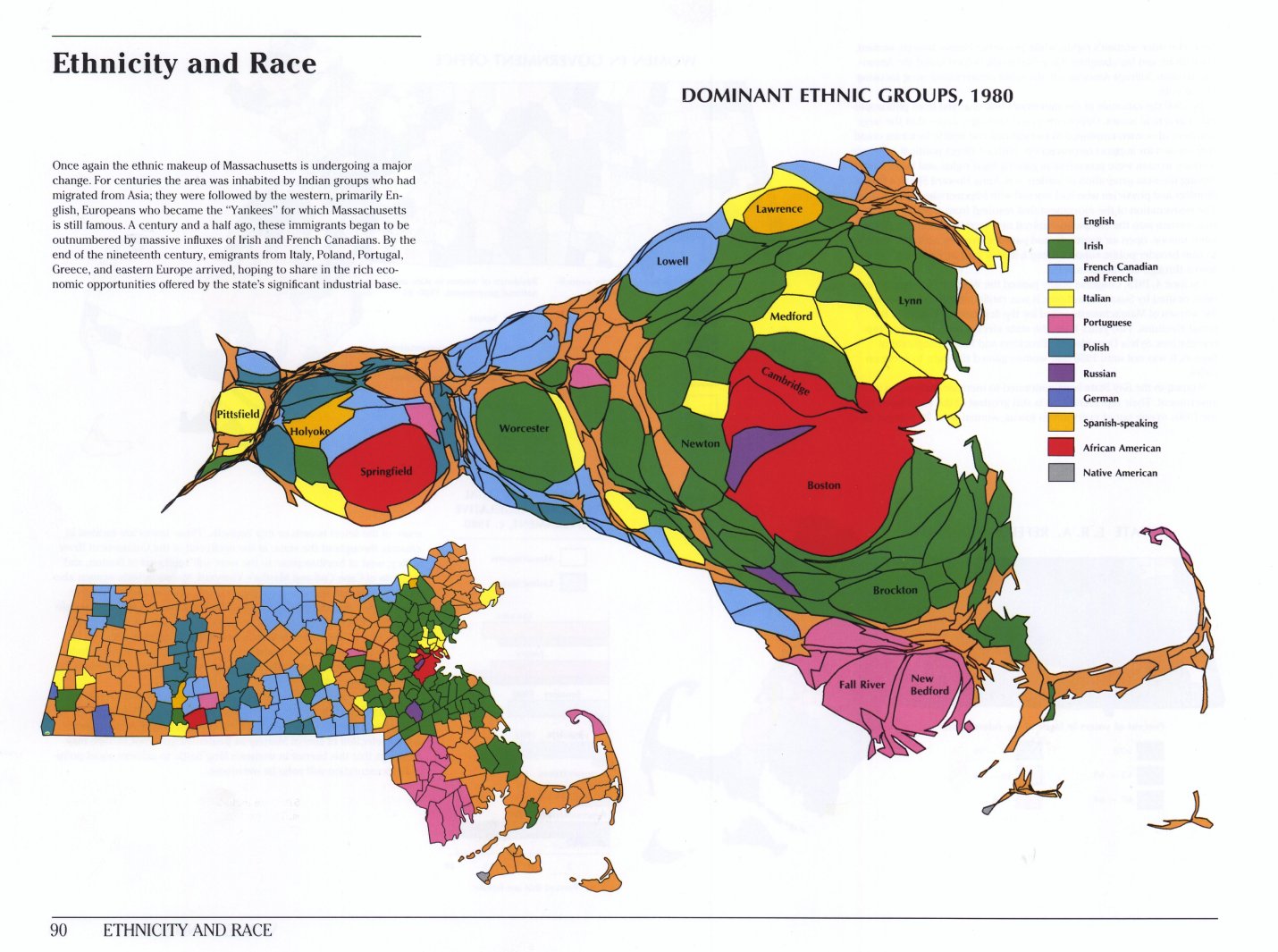 |
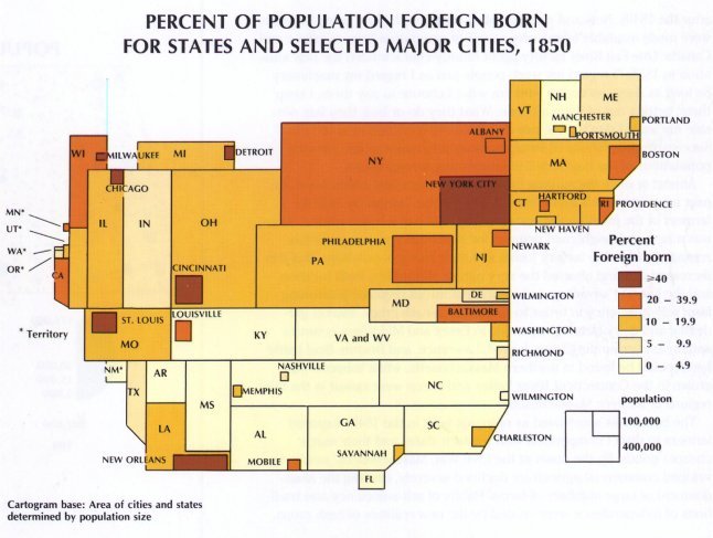
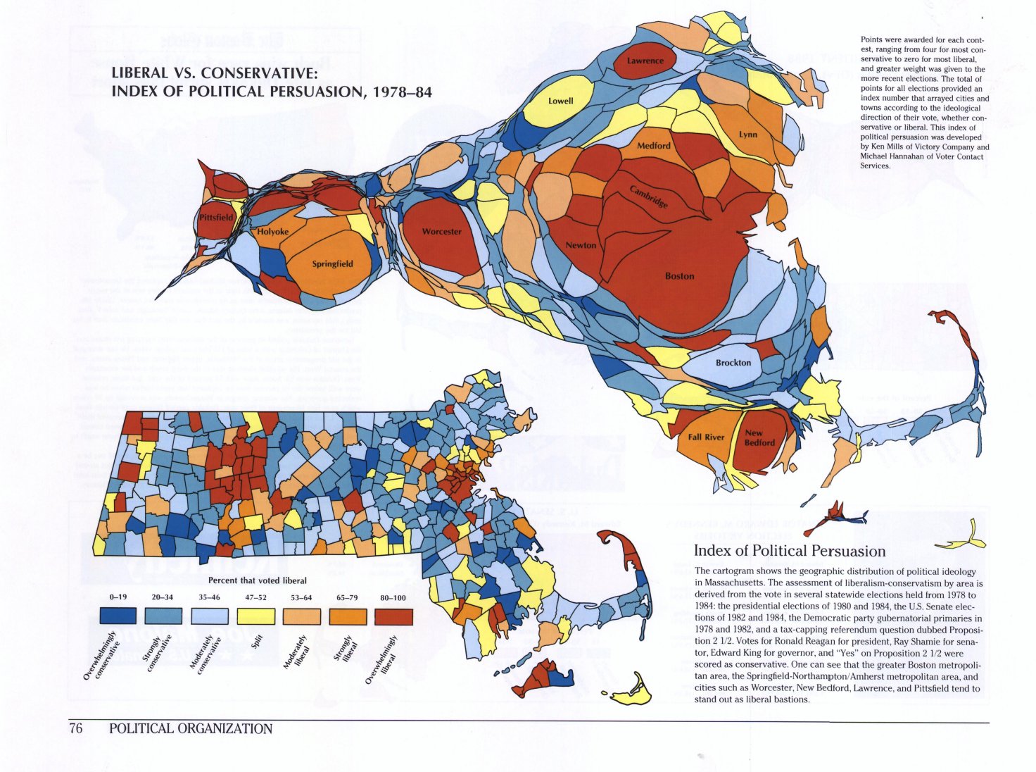
| Page 6: 1930 and 1980. | Page 31: Percent of foreign born population, U.S.A., 1850. | Page 34: The U.S.A. in 1890. | Page 76: Liberal v. Conservative, 1978-1984. | Page 90: Ethnicity and Race,1980. |