Climate & Glaciers
(updated May 2002)
| |
Climate & Glaciers (updated May 2002) |
![]()
We installed an automated weather station on the Northern Icefield in February 2000, very close to one of Lonnie Thompson's ice-core drill sites. Wooden stakes were emplaced to measure mass balance on this glacier, as well as on the Furtwangler and Rebmann Glaciers. Weather data were recovered in February and June of 2001, and continue to be received daily by telemetry. We have made several sets of mass balance measurements, and have also gotten readings from associates.
Little snow cover was present on Kibo in February 2000. Conditions were therefore ideal for acquisition of aerial photographs, as part of a new effort by Thompson and Henry Brecher to map the current glacier extent. On the Northern Icefield at the time, the glacier surface appeared to be typical ablation-zone ice.
How old was this glacier surface? A forthcoming paper on the Kilimanjaro ice-core record (Thompson et al., to appear in Science on 18 October) will present evidence pertaining to this question. Historical accounts of previous scientific investigations are also instructive. For example, in his account of climbing the upper reaches of the Ratzel Glacier, Hans Meyer writes: "It may have caused some surprise
that all along I have continued to speak of ice, and not of snow, as might have
been expected. But, as a matter of fact, at this season of the year there was
hardly any snow on Kibo worth mentioning."
The date was 3 October 1889, three days before Meyer and Ludwig Purtscheller became the first to ascend the mountain. In his book Across East African Glaciers: an account of the first ascent of Kilimanjaro (1891), Meyer goes on to write: "In the great snowfields, which in July
partially covered the slopes of Kibo from the ice-cap to the saddle plateau,
the snow near the base was soft and flaky, whilst higher up it was dry and
granular. In October, when all the snowfields had disappeared, there was
likewise comparatively little snow to be met with on the ice-cap. Over large
areas the surface of the ice was covered with granular morsels, half-way
between ice and snow, the surface of which was slushy during the day and
afforded excellent footing."
Clearly, the mechanism of accumulation well known from glaciers elsewhere (i.e., densification of snow to firn to ice) does not apply on Kilimanjaro. This misunderstanding may be the cause of abundant confusion appearing in recent news reports, such as: “In 15 years, scientists say, the snows of Kilimanjaro will simply melt away” (Time for Kids, p. 4 on 4-24-2001).
In the Kilimanjaro region of Tanzania, precipitation is bimodally distributed – meaning that there are normally two rainy seasons during the year [animation]. Although rainfall does occur at other times, it tends to be concentrated in the “long rains” of March-April-May (approx. 51% of the annual total), and the “short rains” of November-December (24%).
In 2000 the long rains failed to develop over a broad region of eastern Africa, as anomalous large-scale subsidence suppressed precipitation (Lawrimore et al. paper in the June 2001 Bulletin of the Amer. Meteorological Society, v. 82). At the summit we recorded only minor precipitation events. Consequently, we hypothesize that the glacier surface through much of 2000 was less reflective to solar radiation than normal (i.e., lower albedo). Increased absorption of energy therefore occurred, leading to anomalous ablation (sublimation and melt). To date, we have only been measuring incoming solar radiation, but this situation demonstrates the need to also measure the reflected component – something we plan to do in the future.
By about December of 2000, ice ablation since the previous February had reached 1.09 meters near the station! We did not anticipate ablation of this magnitude, which caused our station some technical problems and resulted in a surface-height data gap. However, 0.84 m of snow had accumulated on the ice by early February. This was probably due to precipitation during the prior month, one of East Africa's wettest Januarys in decades. Overall, mass balance at the weather station for our first year of measurements was considerably negative at –0.72 m (water equivalence, w.e.). This was despite the January snowfall, which we estimate to have comprised 59% of the annual total. Measurements on the other two glaciers are consistent with this balance determination.
The 2001 long rains were again well below normal in the region -- but small, episodic events kept the net mass balance at the AWS from decreasing until July. Considerable ablation occurred at the station during August and September of 2001, which the literature suggests is typical. The short rains then resulted in net accumulation, which continued into January. For the second year of our measurements (through January only, 11 months), we estimate a positive mass balance at the site, of +0.13 m w.e.
March 2002 began with a series of snowfall events at the summit, suggesting that the rainy season was off to a good start, but we recorded no precipitation during the second half of the month. April was also dry, but hopefully the long rains will continue soon.
In summary, horizontal surfaces on Kilimanjaro's glaciers have lost mass since February 2000. Vertical walls, surrounding many of the glaciers, have certainly also lost mass even if one assumes that ice motion at the summit is negligible. In the future, we hope to expand our measurement program to both measure vertical wall ablation, and establish the magnitude of ice deformation, if any.
Northern Tanzania precipitation outlook (March-May): Increased likelihood of near to above-normal rainfall.![]()
Document maintained by Doug Hardy (dhardy@geo.umass.edu)
Last updated: 1 May 2002
http://www.geo.umass.edu/climate/tanzania/synopsis.html
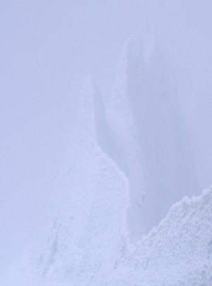
(Background: Ice remnant near the former Eastern Icefield)