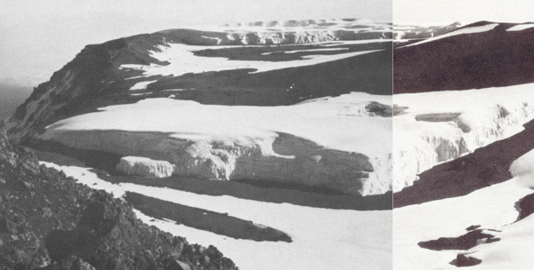
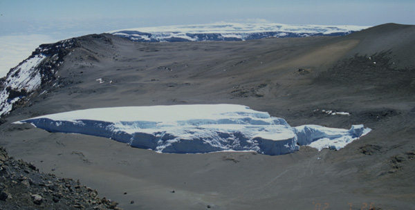
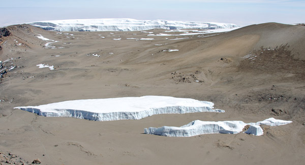
Top image taken by Stefan Hastenrath 14 August 1973, and published in his book The Glaciers of Equatorial East Africa (1984), Kluwer Academic Publishers (image is a composite of Photo 4.1:17b and 4.1:17c). Middle image taken 26 July 2002, and lower on 27 September 2012 (both D. Hardy).
The Furtw‰ngler Glacier area in 1976 was determined to be 113,000 m2 by Hastenrath & Greischar (J. Glaciology, v. 43), using a Landsat 2 MSS scene from 24 January. Analysis of aerial photographs taken 16 February 2000 indicates that the area decreased by half in 24 years, to 60,000 m2 (Henry Brecher, pers. comm. and Thompson et al. in Science, 18 October 2002), and then by more than half again to October 2012 (25,000 m2; D. Hardy data). Particularly dramatic changes took place on the Furtw‰ngler in 2003 and 2004.
![]()