
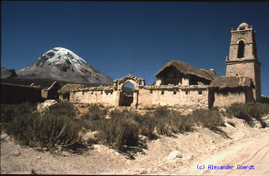
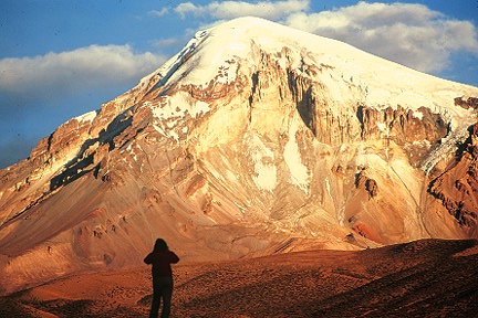
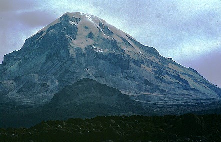
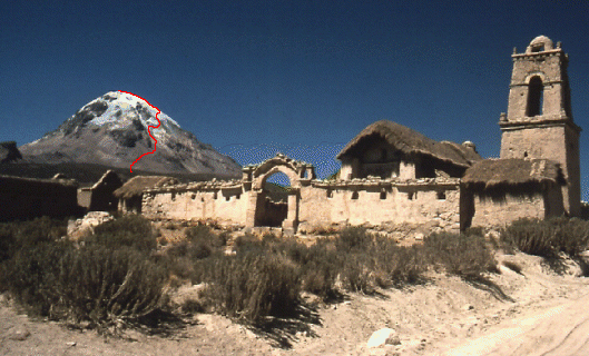
Nevado Sajama is located in the Parque Nacional Sajama, established in 1945. This remote park on Bolivia's south-western border with Chile occupies an area of about 80,000 hectares and includes within its boundaries Bolivia's highest mountain Nevado Sajama (6542 m), an extinct volcano with a large ice cap covering the higher elevations of the mountain. Despite the aridity of the area, the attractions of the park include the world's highest forest, vicunas, rheas, armadillos, flamingoes and Andean condors.
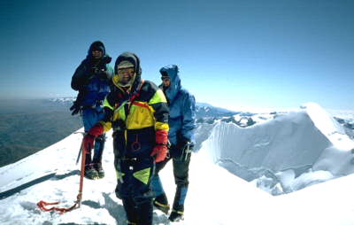
There is no particular season for climbing Sajama, though snowfall can be expected from October - April. Technically, the climb is relatively easy, but the glaciers covering the upper slopes of the volcano are severely crevassed and fairly steep. The usual routes stay on ridges which eventually lead to the icy summit, where there is no trace of any crater. Severe local storms, high winds and the altitude are the main obstacles to any ascent. The mountain was first attempted in 1927 when Joseph Prem soloed the north-west ridge to a height of 6200 m. Several attempts failed due to weather conditions until Prem and his partner Wilfrid Kuehm finally reached the summit of Sajama in August 1939 via the the much more difficult south-east ridge.
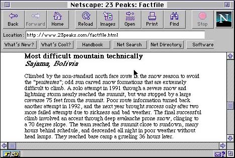
The following is an account from the 23 Peaks Expedition:
We do not expect such severe conditions on the mountain, as our ascent will be in the dry season, around the beginning of September. In addition to the normal climbing and camping equipment we will have to carry approximately 350 lbs. of weather station equipment to the summit, including ice drills and satellite transmitters.
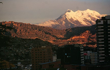
Nevado Illimani (6458 m) is the highest peak in the Cordillera Real, a massive mountain with three summits over 20,000 feet, visible from hundreds of miles out on the altiplano to the west and from far out into the Amazon Basin on the east.
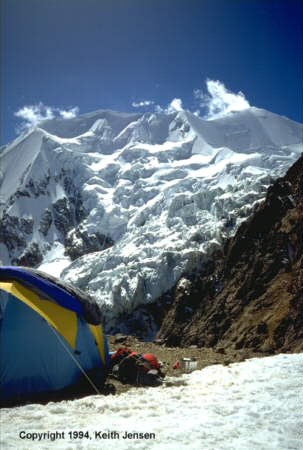
Basecamp for Illimani is usually established at 18,000 feet. The standard route to the summit is the steep southwest buttress. The route is broken by a series of large crevasses, requiring the use of snow bridges and ice ramps whenver possible. A steep 45 degree ice face leads up to the exposed summit ridge and the summit.