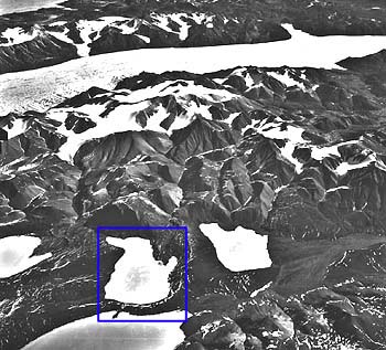
Lake C2 and and its watershed, north coast of Ellesmere Island, 82° 50' N; 78° 00' W

Lake C2 and and its watershed, north coast of Ellesmere Island, 82° 50' N; 78° 00' W
Click inside the blue rectangle to view a topographic map of the Lake C2 watershed.
| Investigator(s): |
|
The topics listed below provide background information on several topics not directly investigated by this study, but nonetheless important to the interpretation of our results. This information provides a geographical, historical, geological, vegetational, and geomorphological context for the current study. The historical background section, for example, demonstrates how recently, and incompletely, the region has been investigated. Each of the other sections addresses one of the factors controlling the yield of runoff and sediment from the watershed. These factors must be considered, for glacial history, and changes in vegetation and geomorphology, can result in a low-frequency trends in sediment yield through time. Geology interacts with all of these other topics, along with being an important control on the overall magnitude of suspended sediment concentration.