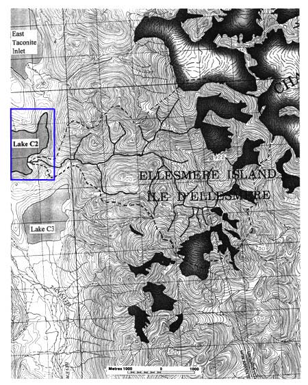
Lake C2 and the watershed (1:50000 scale). Lake C2 drainage divide indicated by dashed line; glaciers are shaded. Contour interval = 10 m (after EMR, 1992)
Click inside the blue rectangle to view a photograph of Lake C2.
Taconite Inlet Project Homepage