Surficial Geologic Maps
|
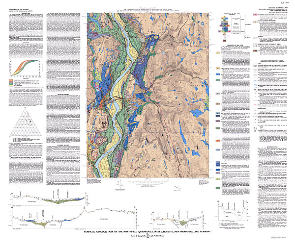
Surficial geologic maps show the type and distribution of deposits on the earth’s surface that lie on top of the bedrock. These deposits are typically unconsolidated sediments (not cemented into rock) comprised of gravel, sand, silt and clay in various mixtures. Massachusetts was completely covered by a continental glacier 14,000 to 20,000 years ago. This event left behind a blanket of unconsolidated surficial material. Some of the material left behind is glacial till (a thick heterogeneous mixture of gravel, sand, silt and clay). Other sediments were deposited by meltwater streams as alluvium (thick deposits of sand and gravel) or deposited in temporary lakes as fine-grained lacustrine sediments. In some areas, thick deposits of windblown sand (sand dunes) or silt (loess) were deposited. Surficial geologic maps show the horizontal arrangement of these materials. This information is critical to knowing where our important aquifers, recharge areas and sand and gravel resources are located. Below
is an example surficial geologic map of the Northfield quadrangle
(Massachusetts, New Hampshire, Vermont). Clicking on a particular
zone of the map will pop up a zoomed-in view of that zone in a
new browser window. When reconstructed, the whole image is 2924x2455
pixels in size, or approximately 41” x 34” in real life at 72
dpi. |
||
|
||
Questions / Comments / Problems with our website? Please let us know: jkopera@geo.umass.edu
webpage last updated 7/2006