Bedrock Geologic Maps
|
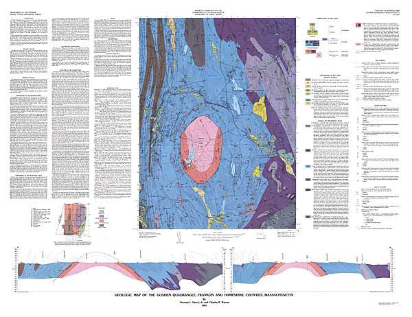
Bedrock geologic maps show the type, age and distribution of bedrock near the earth’s surface. In other words, the maps depict the bedrock that would be exposed at the earth’s surface if the soil and vegetation were completely removed. Each rock unit is identified and named based on distinctive characteristics that can be mapped over large distances. Bedrock geologic maps also show geologic structures such as faults, fractures and folds. Each map is provided with a written explanation and legend that describes the rocks, structures, history of deformation, tectonic setting and any economic potential. Below
is an example bedrock geologic map of the Goshen quadrangle (Franklin
and Hampshire Counties, Massachusetts). Clicking on a particular
zone of the map will pop up a zoomed-in view of that zone in a
new browser window. When reconstructed, the whole image
is 3193x2458 pixels in size, or approximately 44” x 34” in real
life at 72 dpi. |
||
|
||
Questions / Comments / Problems with our website? Please let us know: jkopera@geo.umass.edu
webpage last updated 7/2006