 |
|

Curriculum Vitae
Research
Publications
Media Outreach
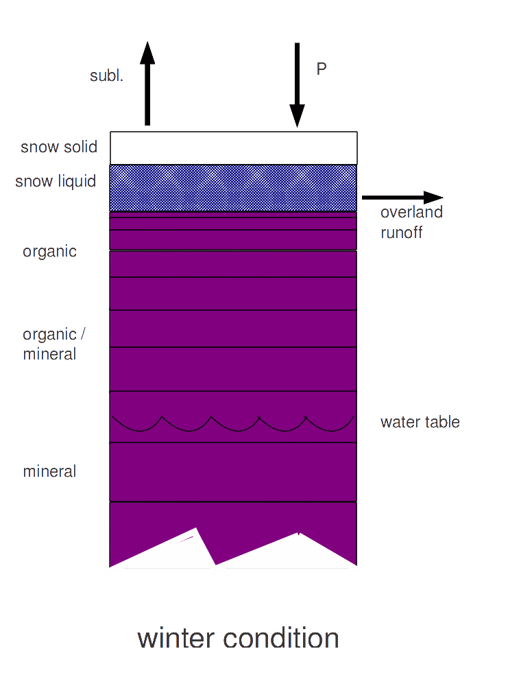
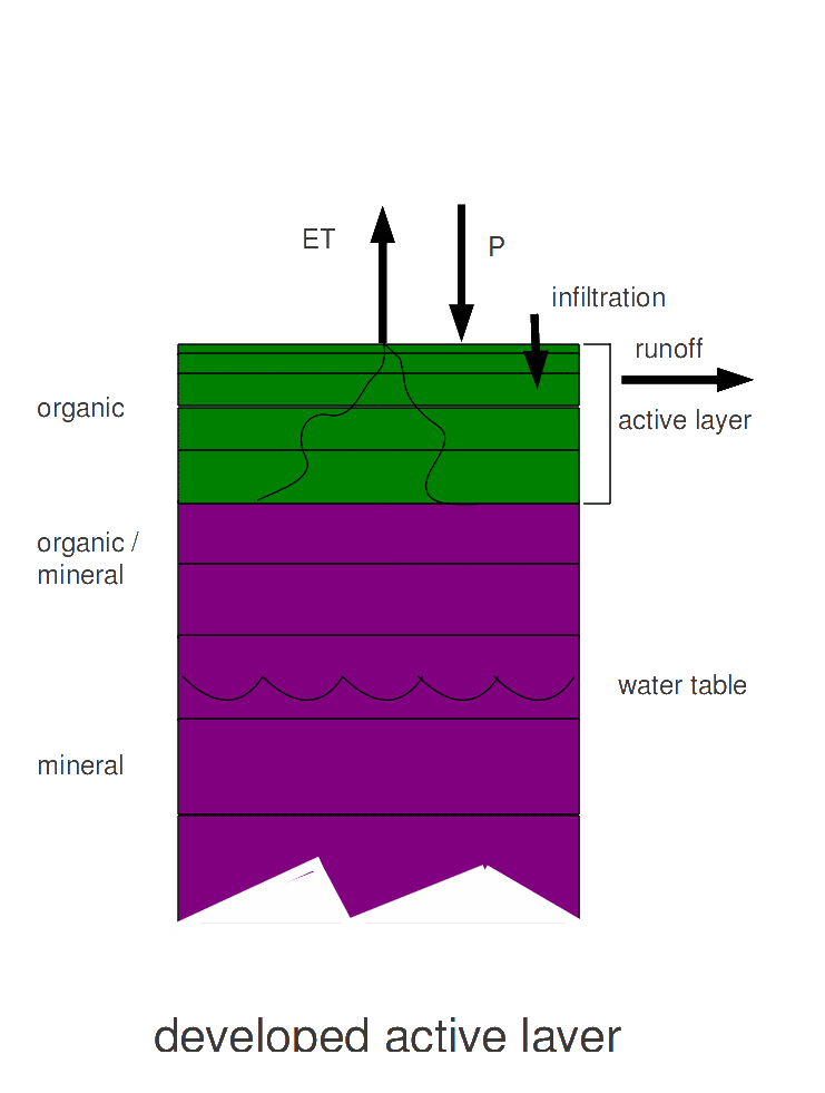
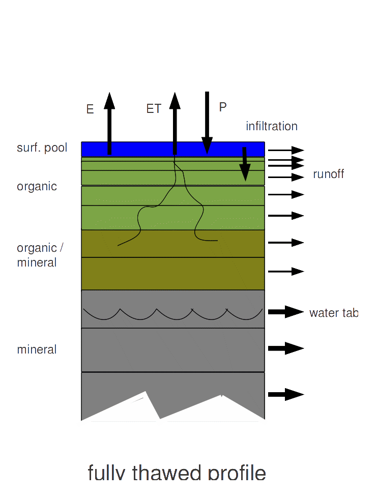
The Arctic water cycle in intimately linked with carbon and energy cycles. Climatic warming and human influences are altering the magnitude and timing of hydrological storages and fluxes across the pan-Arctic region, with the possibilty that terrestrial areas may soon transition from a surface to more groundwater-dominated regime. The Pan-Arctic Water Balance Model (schematic below) simulates all major elements of the arctic water cycle and has been applied in several recent studies. Its initial formulation and a set of upgrades were described in Rawlins et al. (2003) and Rawlins et al. (2013)
Rawlins, M. A., D. J. Nicolsky, K. C. McDonald, V. E. Romanovsky, 2013: Simulating soil freeze/thaw dynamics with an improved pan-Arctic water balance model, Journal of Advances in Modeling Earth Systems, 5, 1-17, doi:10.1002/jame.20045
Rawlins, M. A, R. B. Lammers, S. Frolking, B. Fekete, C. J. Vorosmarty, 2003: Simulating Pan-Arctic Runoff with a Macro-Scale Terrestrial Water Balance Model, Hydrological Processes 17, 2521-2539
Below are a series of animations produced from model simulations by Pan-Arctic Water Balance Model (PWBM).
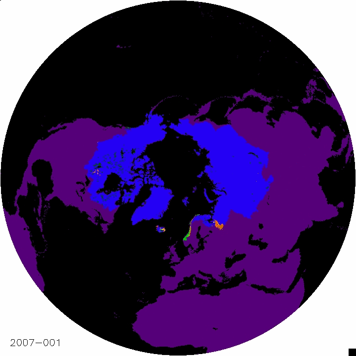
This animation of Pan-Arctic soil moisture shows daily change in moisture content of the upper soil layers from frozen in winter (blue) to thawed in the warm season. The area in blue represents all areas which drain to the Arctic Ocean. Volumetric water content is shown in shades from brown (driest) to green (wettest). Note how weather systems moving from west to east wet the soil, which then dries due to evaporation from the soil and transpiration from vegetation. Note also how the thaw starts in the south and then progresses northward. The shortest thawed season is in northern Siberia.
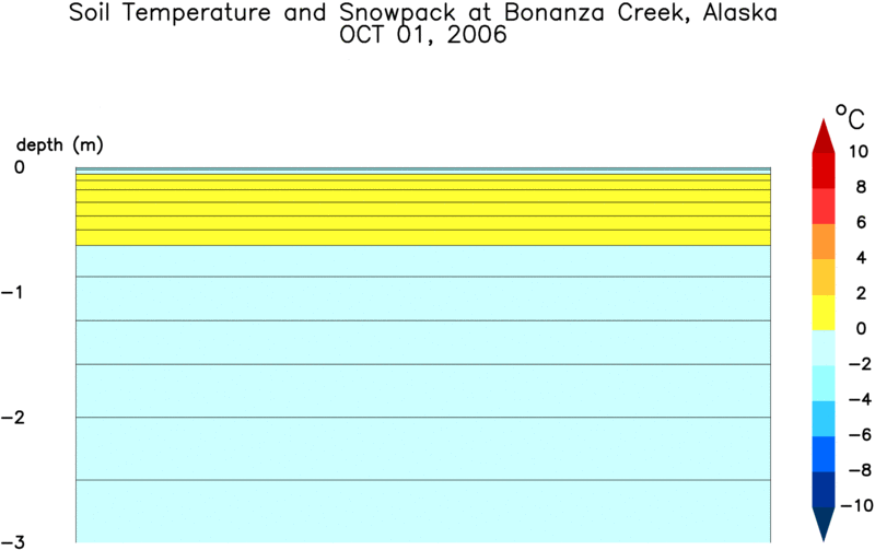
This animation shows changes in soil freeze and thaw for one grid cell encompassing Bonanza Creek, Alaska. While the model simulates dynamics through deeper soil, this animation depicts only the upper 3 meters, where the largest seasonal changes occur. It shows daily temperatures in the soil layers through the year as well as the accumulation and melt of the snowpack. The snowpack changes color from light to dark pink as it melts in late spring. A small ponded surface also develops in the simulations if conditions are right, shown as a blue rectangle above the soil surface.
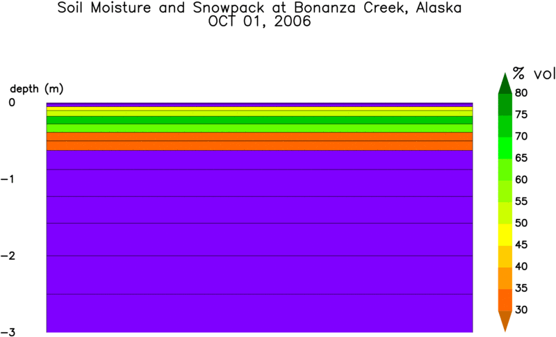
Rather than soil temperature, this animation shows daily soil moisture. Colors indicate the volumetric water content of the soil layers. Layers which are frozen are shown in purple. Note how the upper layers, which are generally porous peat material, have a relatively high moisture content soon after snow melt. Water drains slowly to lower layers with time. Soils dry through the summer through vegetation transpiration and wet when it rains.