To schedule time in the Digital Mapping & Modeling Lab, click here.
The Digital Mapping and Modeling Lab is an 1100 square foot hybrid teaching classroom and research facility. Utilizing the computing power and flexibility of both Macintosh and UNIX platforms, we have created a laboratory for students to use state-of-the art computers for research and in-class interactive learning.
The Dynamic Digital Mapping part 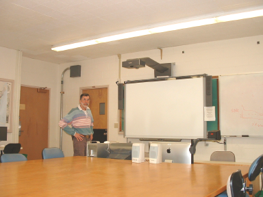 of the lab includes 16 (sixteen) 2.7 GHz 27" iMacs with 12 GB RAM and an extra monitor on each, a Linux based file server (Supermicro AS-2021M-UR w/ 6 1TBDiskk Drives) and various ancillary hardware items (a Smart Board with Short Throw Projector, color printers, scanners (flat bed and slide)]. Software includes VMware, which permits running windows and unix software, PhotoShop, Illustrator, Microsoft Office, Canvas, and the object oriented graphical authoring tool, Revolution in which the DDM work is constructed.
The Geosciences Geomodeling Laboratory includes three high-powered SGI multi-processor servers, dedicated to the simulation and visualization of complex geomechanical and climate-ocean systems. Seven SGI workstations with three dimensional rendering capability are used for both teaching and research. This UNIX-based computing facility includes a suite of sophisticated data processing, numerical modeling, and visualization software.
The classroom is used by various additional geoscience courses, including Geostatistics, Quantitative Geomorphology, and Planetary Geology, with additional supporting software for this including "R" and Stella.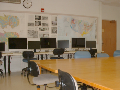
Questions regarding the Geomodeling Lab should be directed to:
• Michele Cooke (cooke@geo.umass.edu) [structural, geomechanical modeling and visualization]
• Robert DeConto (deconto@geo.umass.edu) [climate, ocean, Earth system modeling and visualization]
Questions regarding the Digital Mapping Lab should be directed to:
• Chris Condit (ccondit@geo.umass.edu) [the "Dynamic Digital Map" project, petrology, planetary geology]
The department also hosts a distinct Geographic Information Systems (GIS) Lab.
The development of the Digital Mapping and Modeling Lab was made possible by grants to Chris Condit from NSF-ILI and CCLI, university support, alumni donations and support from Silicon Graphics, Inc., Midland Valley and other vendors.